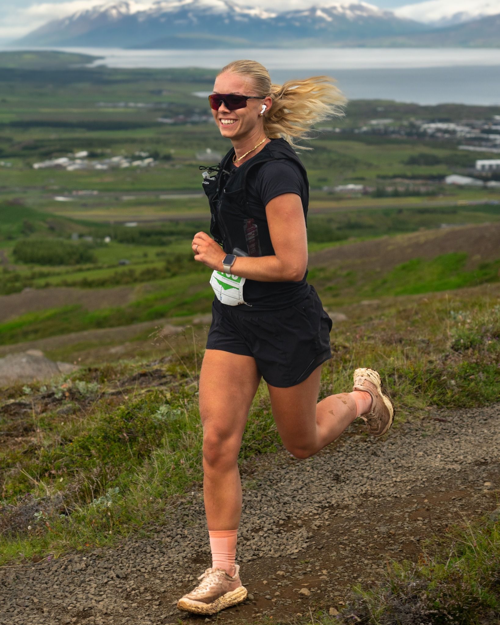
Gyðjan
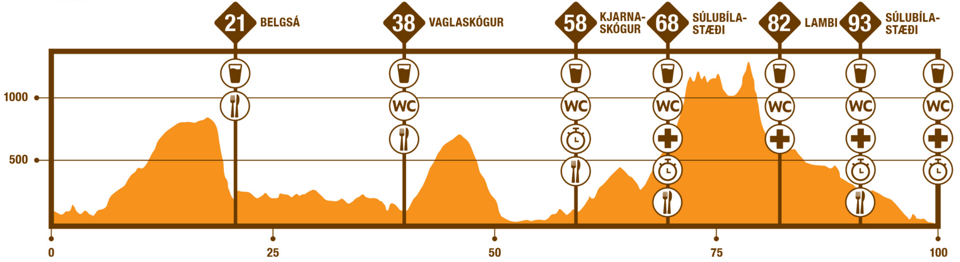
Gyðjan (The Goddess) is a 100 km mountain race with an elevation gain of 3580 m. The race starts at Goðafoss Waterfall and from there the race takes you over Mt. Belgsárfjall and Vaðlaheiði Heath to Akureyri, up Mt. Súlur, into Glerárdalur and finally down to the center of Akureyri.
The race starts at a beautiful viewpoint at Goðafoss Waterfall, about 110 m above sea level. The course takes runners west over the Skjálfandafljót River on a footbridge and along National Road 1 over a bridge at Hrúteyjarkvísl River. Then runners turn south onto Bárðardalsvegur (a trail next to the main road is used), but here, runners are situated in Bárðardalshraun Lava which flowed 9000 years ago. The course turns west onto the driveway to Öxará farm, where the first incline begins. The path follows about 4 km up on both gravel and heathland to Öxará River crossing at an altitude of 430 m. The crossing is easy, the depth is only mid-calf.
Now runners head west and in about 7.5 km they reach a cairn at the highest point of Mt. Belgsárfjall at an altitude of 830 m. This route is rocky in parts and requires caution. From the cairn you will head southwest to the edge of the mountain (remember to enjoy the view of Fnjóskadalur valley!) and after that you will descend 650 m along the mountain ridge to the deserted Belgsá farm, where you reach the 21 km mark. There you will find the first aid station.
From Belgsá River, runners head north along a lightly traveled gravel road to the bridge at Illugastaður. Do NOT cross the bridge, but continue east of the river and run north through Þórðarstaðaskógur forest, the summer cottage area in Lundsskógur Forest and on trails through Vaglaskógur Forest to an aid station at the 37 km mark. It should be noted that Vaglaskógur Forest is one of the largest natural birch forests in the country, along with Hallormsstaðaskógur Forest.
From Vaglaskógur Forest, cross over the old arch bridge at Fnjóská River, built in 1908. It is 55 meters long and was for a long time the longest stone arch bridge in the Nordic countries. It is also considered by many to be among the most beautiful structures built in Iceland in the 20th century. From the bridge, head up to the main road and follow it south, almost 3 km to Systragil camping ground. Be sure to run on the left side against traffic and be careful.
At Systragil, turn right onto Þingmannaleið trail, which was the main transportation route between Þingeyjarsýsla and Eyjafjörður through the centuries. This is the second ascent of the course with 580m of elevation gain in about 7km. The highest point of this route at Vaðlaheiði Heath is at about 680 m above sea level. Up on the heath there is a remarkable stone bridge dating back to 1871. Then the trail begins to descend and there is a 660 m descent on a good path through gravel and dirt to the road north of Eyrarland farm.
The course runs south along the road for about 500 meters and then continues along a path along the main road for about 1.5 km. There runners head west across Eyjafjarðarbraut east and run along a gravel road over the old bridges on the Eyjafjarðará River. This route used to be the main road to Akureyri from the east. Óshólmar Estuary is a protected area known for its birdlife. The course crosses Eyjafjarðarbraut on a footpath and up to Kjarnaskógur where there is an aid station (at km 58) and runners can access their drop bag. At this aid station assistance is allowed, one pr. runner.
After Kjarnaskógur aid station and about 300 m of elevation gain on a good path you pass Gamli hut and then continue above the cliffs and past Fálkafell hut. From there you run down to the Súlubílastæði aid station. After this aid station (at km 68), the first demanding climb begins up a marked hiking trail to Mt. Súlur.
After about 900 m of elevation gain stretching over about 5km, the summit of Mt. Súlur is reached and then runners continue over to Mt. Syðri Súlur and then south along the mountain range, passing smaller peaks, such as Krummi and Litli Krummi. Then you turn down into Lambárdalur Valley, over Lambárjökull Glacier and up to Mt. Lambáröxl. From there, down into Glerárdalur Valley to the Lambi hiking hut. This part of the route is quite technical, rocky and steep in parts and we recommend that you proceed with caution here.
At Lambi there is an aid station (82km) run by the Súlur Search and Rescue team. From Lambi, a marked trail runs 11 km back to the Súlubílastæði aid station (93km). From Súlubílastæði, the route is over Glerá River and then follows a path known as Fallorkustígur along the Glerá River down to Hlíðarbraut road. The race crosses over Hlíðarbraut and continues along the Glerá River to the University of Akureyri. Finally, the last 2–3 kilometers are run along city streets to the Akureyri City Center finish line.
Runners in Gyðjan must have a track of the route on a watch or phone.
Starting time
- The race starts at Goðafoss waterfall in two groups.
- 21.00 First group (runners with less than 600 ITRA points), buses leave Hof Culture House at 19.45
- 02.00 Second group (runners with over 600 ITRA points), buses from Hof Culture House at 00.45
Cut off times
- It is estimated that runners in the first group can complete the race in 22 hours and runners in the second group in 17 hours. Runners must, therefore meet, the following cut off limits along the route, which are based on the times exiting the aid stations.
- Kjarnaskógur aid station: first group at 9:00, second group at 11:00
- Súlubílastæði aid station on the way up: first group at 11:30, second group at 13:00
- Súlubílastæði aid station on the descent: first group at 17:30, second group at 18:00
- Runners who do not meet this time limit must withdraw from the race. This rule applies to all participants and is non-negotiable.
Mandatory equipment
- Bottle/cup 0.5 l minimum (there will be no cups at the aid stations)
- A fully charged phone with the emergency number 112 saved, along with the race director's phone number: 860 0636
- Thermal foil blanket, no less than 130 x 200 cm
- Headlamp
- Whistle
- Jacket
- Buff/hat
- Mittens
- Elastic band/tape (100 x 5 cm)
- Energy equivalent to a minimum of 600 kcal
The following may be added as mandatory equipment if the weather forecast predicts cold/wet conditions. A notice will be issued two days before the race if needed:
- High socks/calf guards or long pants
- Extra sweater
- Waterproof mittens
- Waterproof jacket
Poles: It is permitted to run with poles, but the rule is that you must run with them the entire race - if you start with poles you need to finish with poles.
During the race, participants must carry the mandatory equipment and be prepared if race officials request to see the equipment before the start of the race, during the race and at the finish line. Missing mandatory equipment will result in a time penalty (15–60 minutes added to the participant’s final time, depending on how much mandatory equipment is missing). A participant may be disqualified from the race if a significant amount of mandatory equipment is missing.
Aid Stations
| Industry | Belgsá - 21 km | Vaglaskógur | Kjarnaskógur | Súlubílastæði - 68/93 km | Lambi - 82km |
|---|---|---|---|---|---|
| Water | x | x | x | x | x |
| Gatorade | x | x | x | x | x |
| Pepsi | x | x | x | x | x |
| Salty pretzel | x | x | x | x | x |
| Cinnamon rolls | x | x | x | x | x |
| Caramel | x | x | x | x | x |
| Bananas | x | x | x | x | |
| Oranges | x | x | x | ||
| Talk | x | x | |||
| Cocoa | x | ||||
| Drop Bag / Support | X |